• Sign in
  • |

Home Oblique Imagery

Choose your language

  • Deutsch
  • English

Tag: Oblique Imagery

GGS Webinar
Webinar

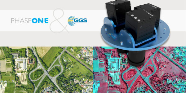
An overview of 20 years of Phase One aerial surveying sensor integration by GGS

Webinar

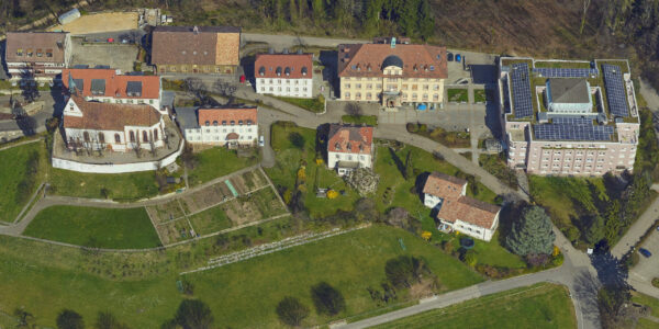
Large format oblique mapping at 880 MP from the imaging experts

Webinar

Generation of 3D Imagery by Oblique Systems with Phase One and Skyline Software Systems

Webinar

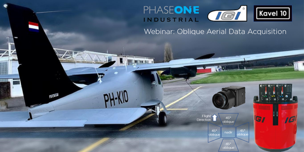
Oblique Aerial Data Acquisition using Phase One Cameras integrated by IGI (Germany) and operated by Kavel10 (Netherlands)

aerial 3d model | Multi-sensor aerial imaging system For Geospatial Precision in 3D City Modeling
Geospatial

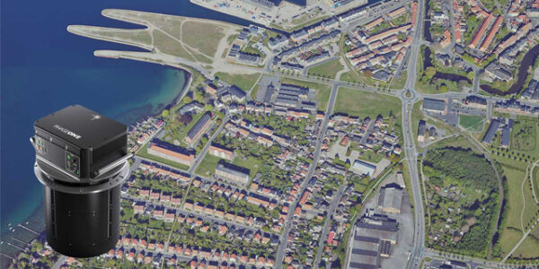
Aerowest – Creating 3D City Models in a Single Flight

  • Applications
    • Geospatial Imagery
    • Space
    • Heritage
    • Bespoke Photography
  • Solutions
    • Geospatial solutions
    • Space solutions
    • Heritage solutions
    • Photographic Cameras
  • Knowledge Hub
    • Case Studies
    • Events overview
    • Inspiration
    • Press Releases
    • Video Hub
  • About
    • Find a Local Geospatial Partner
    • Find a local Photography Partner
    • Find a Local Heritage Partner
    • Find a rental studio
    • Phase One Certified Professional
    • Careers
  • Contact us
  • Legal
  • Privacy Policy
  • Cookie Policy
  • Terms and Conditions
© Phase One 2026
  • Legal
  • Privacy Policy
  • Cookie Policy
  • Terms and Conditions